On new paths: Hiking in the South of France - 6 routes
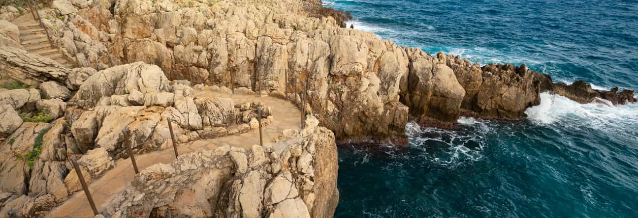
Hiking in the South of France – that means more than just altitude and hiking poles. It's the rustling of pine needles under your shoes, the shimmering Mediterranean Sea between two rocky curves, the scent of lavender, or the echo of footsteps in ochre-colored gorges.
Our guests have embarked on very special trails: from the Côte d'Azur to the Maritime Alps. They demonstrate that hikes in the South of France are as diverse as the landscape itself. Sometimes they are easy and colorful, sometimes challenging and tranquil, but always full of views, memories, and places you'll want to return to.
Be inspired: to new routes, to a true experience of nature, to a hiking holiday in the South of France that will linger long after you leave.
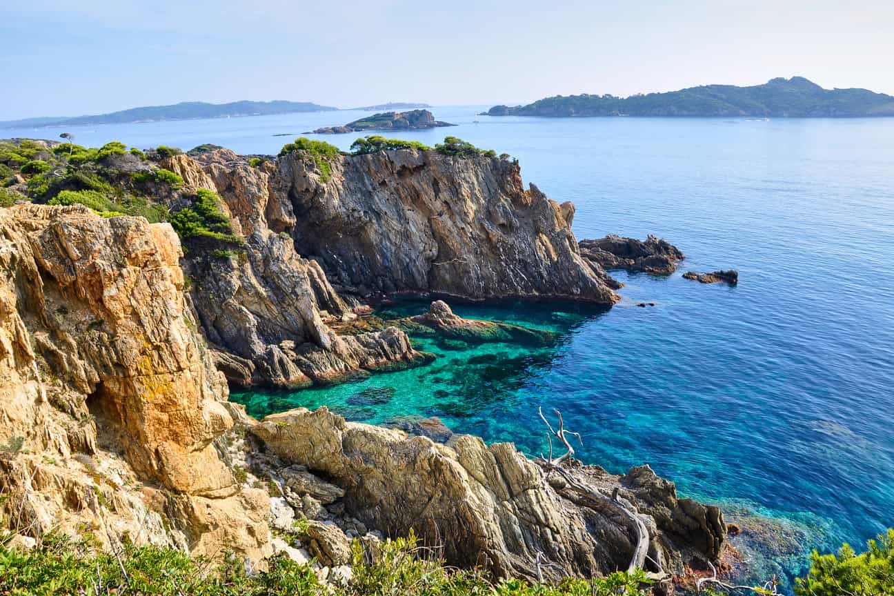
From above the coast – the steep cliffs of Giens with stunning sea views on the Côte d’Azur
Tour 1: Hiking in Southern France on the coast - Giens Peninsula for experienced hikers
Jean-Marc is a passionate hiker and has been regularly drawn to nature with his wife for over twenty years. For their last hiking holiday in the South of France, they chose a holiday home from casapilot as their starting point and from there set off on a challenging tour along the coast: the circumnavigation of the Giens peninsula in the protected area of the Port-Cros National Park. They found the route on komoot, a great online route planner.
The starting point is at the bus stop in Giens (4 Pl. Saint-Pierre, 83400 Hyères). From here, they follow a challenging circular route: 11.7 kilometers, over 200 meters of elevation gain, narrow coastal paths, cliffs, steps, and breathtaking views. In total, they were on the trail for 3.5 hours. The route is considered difficult: surefootedness, good fitness, and sturdy footwear are required.
After about 3.8 kilometers, they reach the first highlight: a viewpoint with views of Île Longue and Île de la Ratonnière. The scenery is particularly impressive in a mistral wind, when the waves crash against the cliffs.
A little later, at kilometer 4.5, they gaze at the Pointe des Chevaliers. In summer, however, it can get busier here. So, those seeking peace and quiet should come outside of peak season or simply move on quickly to the next hiking highlight.
Another magical moment follows after about 5.2 kilometers: the view of the Giens Peninsula – turquoise water, jagged rocks, and dazzling light.
At kilometer 6, the couple reaches the Giens Peninsula and an old military pier. Access is a bit of an adventure: a narrow, steep staircase made of limestone blocks leads down. Only for those with a head for heights and after climbing a small wall! Those who dare will discover a small grotto and a former shelter below – a hidden spot with character, but not suitable for swimming.
From kilometer 7 onwards there is a small bathing area: the Plage du Postillon. A pebbly beach, perfect for a short break. Water shoes are recommended, but not required.
After a good three more kilometers, Jean-Marc and his wife reach the bus stop in Giens again. Tired, fulfilled, and with the feeling of having experienced something truly special.
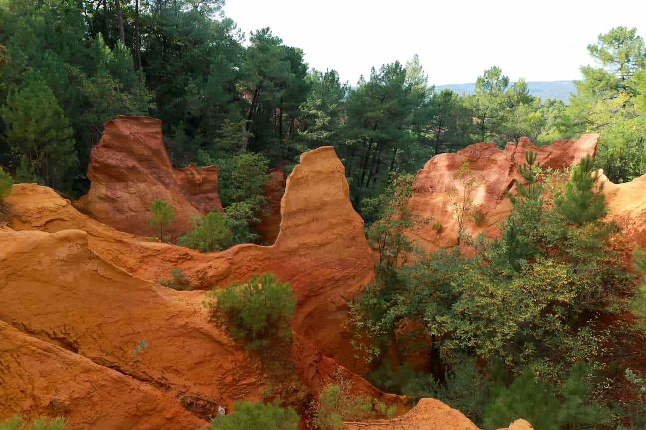
A splendid display of colours in nature – the Ochre Trail near Roussillon with trees and impressive landscape
Tour 2: The Ochre Trail of Roussillon - A Colourful Hike in Southern France for All the Senses
Julia and her friend spent their holiday in the South of France in a holiday home in Provence. For their relaxing day of hiking, they were looking for a short but special route. They chose Le Sentier des Ocres. This ochre trail leads through a bright red sea of rocks, more reminiscent of Arizona than France.
There are two routes to choose from – both well-marked and suitable for inexperienced hikers
Route 1: Vue sur Roussillon – Sentier des Ocres Loop Start/Finish: Ocres Parking Lot Duration: 29 min Length: 1.68 km Difficulty: easy
A short walk with maximum color experience. After just a few meters, fantastic views back to the ochre-colored village open up. Highlights: the ochre cliffs of Roussillon, a sundial, and the information panels on the geological origins of this color world.
Route 2: Sentier des Ocres – Village de Roussillon Loop Start/Finish: Saint-Joseph parking lot Duration: approx. 1:03 h Length: 3.75 km Difficulty: easy
Julia and her friend chose this route for a bit more exercise and, after the ochre path, explored the village of Roussillon. In addition to the colorful cliffs, they discovered the charming village center with its market square, the Église Saint-Michel bell tower, and the Belvédère viewpoint. Their conclusion: Ideal for a half-day trip. Impressive nature, colorful photos, and café visits await you at the end. Caution: The yellow ochre sand stains heavily, so wearing light-colored clothing is not a good idea.
Our holiday homes in the South of France
Luxurious Villa with Magnificent Views, Outdoor Pool and Modern Interior near Nice and Saint Paul de Vence
An exceptional renovated house with private swimming pool, ideally situated in the heart of an authentic Provencal village.
Holiday home in the historical centre of Bonnieux, with jacuzzi, for 6+2 people
Tour 3: At Cap d’Antibes - Coastal hike between stairs and dream villas
For Elena and her partner, it was clear: their hiking holiday in the South of France should not only be uphill, but also take them directly along the sea. They came across a route on Komoot that promised just that: the Circumnavigation of Cap d'Antibes. The trail begins at a small parking lot on the coast and takes you around the headland in about 1.5 hours. Their accommodation: a charming Southern French villa from casapilot nearby.
Tour of Cap d'Antibes Start/Finish: Parking lot at Cap d'Antibes Duration: 1:17 h Length: 4.88 km Difficulty: easy
The trail is easy to walk, but not without its challenges: narrow coastal paths, many steps, and slippery sections in places. Sturdy footwear is recommended here as well. A real highlight awaits you right after the start:
- Coastal Path around the Cap (from 493 m): Constantly accompanied by the sound of the sea, the path offers spectacular views – varied, natural, sometimes rocky, sometimes green.
- Pointe de la Garoupe (2.59 km): One of the most impressive viewpoints along the route. Here, coastal scenery meets postcard views.
- Billionaires Beach (3.25 km): This bay (Bay of Billionaires) is not without reason. Luxurious villas are hidden here, adorning the coastal panorama. The bay was once only accessible by boat, but today the hiking trail leads right past it, albeit at some distance from the privacy of the properties.
- Drinking Water Point (3.86 km): Ideal for a short break.
After about an hour, the two reach the starting point again – with the feeling of having experienced an exclusive side of the Côte d’Azur on foot. Their tip: set off early in the morning when the path is still quiet. This way, you can enjoy the most beautiful aspects of hiking in the South of France!
Tour 4: In the Maritime Alps - To Lac d’Allos at 2,230 meters
If you are looking for alpine landscapes while hiking in the South of France, you will find them in the Mercantour National Park. Lisa and her boyfriend are spending their hiking holiday in a Casapilot holiday home not far from Nice. For the highlight of their trip, they choose a challenging but rewarding route: the hike through southern France to Lac d’Allos, the largest natural high mountain lake in Europe. They found the route on komoot: 21.7 kilometers, 950 meters of elevation gain, over 7 hours of walking time. The tour requires very good fitness, surefootedness, and plenty of water in your backpack.
From the starting point "Parking du Laus", after just a few kilometers, a bridge leads over the Torrent de Valplane, after which you continue to climb through larch forests and over alpine meadows. Soon they reach the Cascade du Chadoulin, a rushing waterfall cascading photogenically over rocks.
After a good 9 kilometers, they reach their first vantage point: View of Lac d'Allos. The lake still lies below them, a turquoise-blue mirror between rocky peaks. The moment is tranquil, impressive, but the real highlight is yet to come.
A little later, the trail leads to the circular path around the lake. There, the two discover a small stone chapel, a silent symbol of mindfulness. Shortly after, they reach the Refuge du Lac d'Allos, a rustic mountain hut where they can stop for a bite to eat or even spend the night.
It's not until kilometer 10.9 that they truly reach the lakeshore: Lac d'Allos, at 2,230 meters, lies almost motionless under the sky. The view of the surrounding valley is so vast and clear that you inevitably linger longer than planned.
On the way back, they meet other hikers who are just starting out. Lisa is grateful they started early. Her conclusion: This hike in the French Maritime Alps is one of the most beautiful she's ever done – challenging, tranquil, and full of panoramic views.
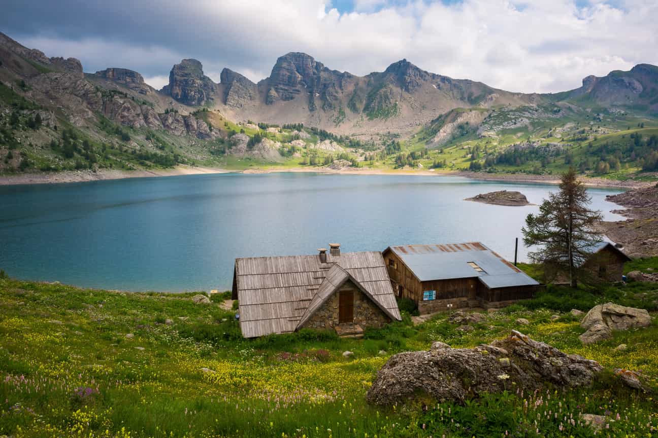
Natural idyll at Lac d’Allos – clear view from the shore of the alpine mountain lake in Provence-Alpes-Côte d’Azur
Tour 5: Along the Verdon Gorge - Rock faces, river views & panorama
Sabine chose accommodation with casapilot for her hiking holiday in Provence – with a very specific goal in mind: the famous Verdon Gorge, often referred to as the Grand Canyon of Southern France. The gorge stretches over 25 kilometers in length, is up to 700 meters deep, and offers numerous hiking options. Sabine opted for a moderately difficult circular hike.
Pont d'Estellié – View of the Gorges du Verdon Loop Start/Finish: Parking Lot Duration: 2:59 h Length: 8.08 km Difficulty: moderate Ascent: 500 m
The trail is easy to walk, but exposed in places, so a good level of fitness and a head for heights are beneficial. The route runs partly along the famous Sentier Blanc-Martel, the most famous hiking trail in the region.
Sabine's highlights along the way:
- Chalet de la Maline (after 6 m): Shortly after the start, Sabine reaches this panoramic hut with a view of the gorge. It serves traditional cuisine and offers overnight accommodation – reservations are essential.
- House on the Steep Slope (1.37 km): Built directly into the rock face – a quiet, almost surreal sight.
- Belvédère (1.42 km): A viewpoint with spectacular views of the gorge.
- Grand Canyon du Verdon: Hiking through the gorge.
- Pont d'Estellié(2.6 km): The bridge offers a dizzying view of the Verdon Gorge.
- Section of the Blanc-Martel Trail (3.27–6.5 km): Sabine follows part of the region's most famous hiking trail. Particularly impressive are the vertical cliffs and the depth of the canyon right next to the trail.
- Panoramic View of the Gorges du Verdon (6.59 km): One last panoramic view over the valley—a place for a long break.
Tour 6: Hiking in the South of France on Lavender Routes
Provence in summer? It's not just sunshine and the south, but also lavender. When entire slopes and plateaus transform into a vibrant violet, a special magic hangs in the air. Anyone hiking in the South of France during this time will experience the region at its most poetic.
Particularly worth seeing are the Plateau de Valensole, the area around the Abbey of Sénanque near Gordes, and the Pays de Sault. There is also an official lavender route in the lesser-known Drôme Valley, with numerous viewpoints and small distilleries along the way. The hikes in the South of France lead through fields, plateaus, and past charming villages – sometimes easy, sometimes with a slight incline, but always with magnificent scenery.
You can find all the tips, suitable locations, and two inspiring lavender routes here in our detailed blog article: The Lavender Route of Provence.
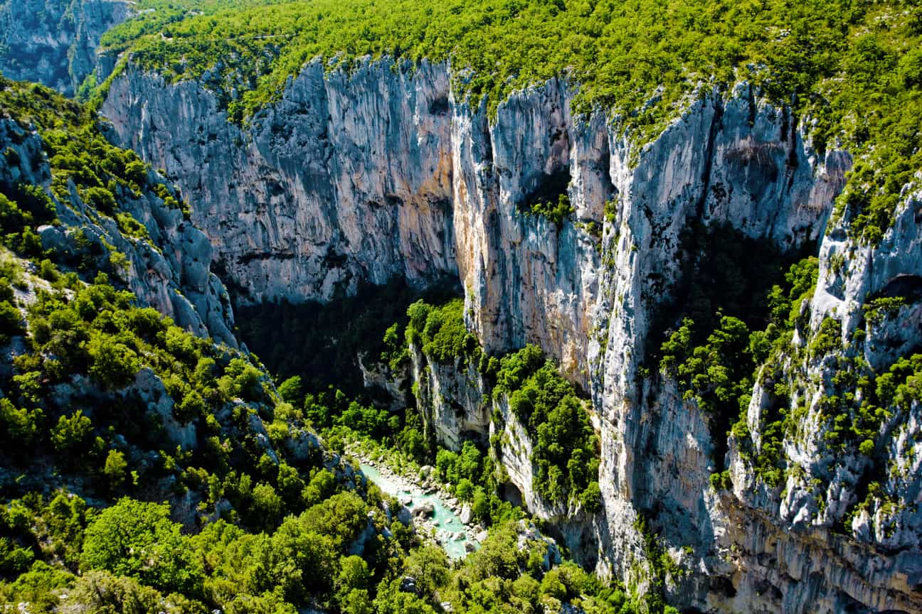
Breathtaking view of the Gorges du Verdon – aerial view of the impressive gorge landscape in Provence
Hiking in the South of France – variety for every taste
Whether rugged coastal paths, alpine lakes, glowing red cliffs, or Mediterranean gorges: Southern France offers hiking trails that will leave a lasting impression. Each route has its own character and combines nature, culture, and exercise in a unique way. Thanks to the varied difficulty levels, both ambitious outdoor enthusiasts and leisurely walkers will find what they're looking for.
And best of all: With a casapilot holiday home near the most beautiful hikes in Southern France, you have the perfect starting point for your tours. Enjoy everything at your own pace, with every comfort.
So: lace up your hiking boots and set off – Southern France awaits.